Cropmap: never guess at crops again
Which crops grow where? The answer to that question is critical to support farmers, industries and authorities. Cropmap gives you that answer. Cropmap shows you all Belgian arable land and what it is used for. The map combines satellite data and artificial intelligence to give you an overview of our agricultural landscape in just a few clicks
What is being cultivated where?
Early in the growth season, Cropmap assesses which crops are being cultivated where by analysing fields using satellite imagery. The map focuses on the most important crops in Belgium: corn, winter wheat, winter barley, potatoes and beets. It also shows which fields consist of grassland, on which ones fruit trees are being grown and where a less popular crop is possibly being cultivated.
Agricultural landscape on the map
Cropmap forecasts the Belgian agricultural landscape based on satellite data and CropSAR technology. Among other things, the tool helps authorities and suppliers to evaluate harvests at an early stage and to monitor crop rotation. In addition, Cropmap supports the Common Agricultural Policy (CAP) and further complements the information from the CAP registration of parcels.
- agricultural suppliers
- consultancies
- international food organisations
- authorities in countries without adequate agricultural data
- Locating fields through a simple search
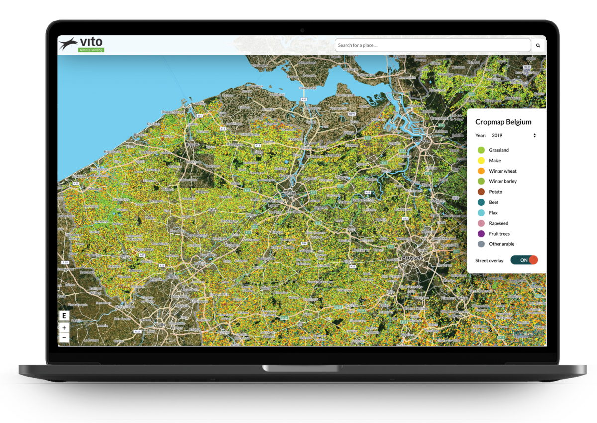
Easily consult the Belgian Cropmap (for 2018 and 2019) at app.watchitgrow.be/cropmap. You can search a field by address or zoom in manually. Using deep learning techniques, the app shows which crops are being grown there. To do so, Cropmap combines optical and radar satellite data.
- Streamlining agricultural supply chains
It is in the best interest of agricultural suppliers to know as soon as possible how much nutrients they have to stock up on. This is only possible if they know what crops are being cultivated. Cropmap lets them know early in the season. The WatchITgrow application, which also uses CropSAR technology – shows even more details about the cultivated crops. This helps to closely monitor and adjust growth.
- Providing support for food supply
Belgian authorities closely monitor which crops are being grown. In other areas of the world, it is often guesswork as to what is being cultivated. To this end, Cropmap provides critical information to countries that don’t have access to adequate agricultural registration systems. Using Cropmap, they too are able to monitor crop rotation and forecast harvests.
What you gain by using Cropmap
- Insight into the Belgian agricultural landscape early in the season.
- Know exactly which crops are being grown where.
- Adjust the supply of crop nutrients based on actual demand.
- Closely monitor crop rotation.
- Assess the risk of contamination by other crops in neighbouring fields.
- Receive additional support for the implementation of the Common Agricultural Policy (CAP).

Key figures
92%
Cropmap was 92% accurate for Belgium in July 2019. This provides suppliers with valuable and timely insight into agriculture.
927,752
In 2018, Cropmap detected 927,752 individual agricultural parcels in Belgium of at least 0.25 ha. With this method, each parcel is automatically outlined.
4,7 %
With support of the Cropmap we can deduce that 4.7 % of our Belgian agricultural parcels are potato crops.
Products and services

Sentinel-1
Sentinel-1 radar data guarantees useful information about crops in all weather conditions. It also provides information on the structure and moisture content of soil and crops.

Sentinel-2
The multispectral images from the Sentinel-2 satellite delineate parcel boundaries on the Cropmap and provide insight into the crops’ biophysical activity throughout the season. This information is critical to be able to recognise crop varieties.

CropSAR
CropSAR technology makes it possible to regularly monitor crop status, regardless of weather conditions. CropSAR uses radar data from Sentinel-1 for observation during critical growth phases.
