Terrascope will stop producing INSPIRE metadata at product level. The removal of existing product-level INSPIRE metadata will take place from 1 March 2026 onwards. Read more
Measuring Nitrogen Dioxide From Space
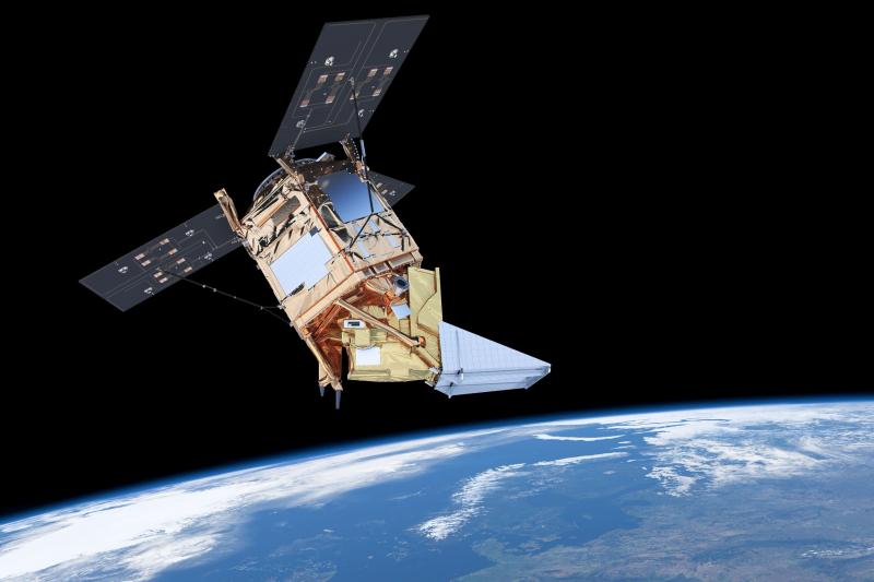
Sentinel-5P TROPOMI is a satellite instrument designed to observe and monitor atmospheric gases and air pollution. Daily global NO2 detection and monitoring at sub-urban scale is possible, which among others results in improved air quality modelling.
Monitoring air pollution
Air pollution is a permanent source of concern in the densely populated and highly industrialized Benelux area. According to a 2019 report of the European Environment Agency (EEA), it causes 400,000 premature deaths in Europe every year and it increases risks on respiratory problems and heart and vascular diseases.
Fighting air pollution is extremely important. It requires an integrated strategy, with a role for:
- emission inventories
- ground-based and satellite observations
- computer modelling
Daily global NO2 detection and monitoring at sub-urban scale
Monitoring Nitrogen Dioxide from space
One of the most important polluting gases is nitrogen dioxide (NO2). It is a reactive gas, known to cause problems to the human respiratory system and it is involved in particulate matter and ozone creation. It is produced in traffic and industry combustion processes and therefore indicates human economic activity. NO2 also plays a role in natural environments’ biodiversity reduction through nitrogen deposition. Its presence in the atmosphere is currently routinely measured from space by the Tropospheric Ozone Monitoring Instrument (TROPOMI), thereby enabling to identify NO2 emission sources and to monitor its evolution and spatial dispersion.
Copernicus Sentinel-5P TROPOMI
TROPOMI was launched in October 2017 on-board the Sentinel-5 Precursor (S-5P) satellite. It is the first satellite mission for atmospheric chemistry in the Sentinel series, developed within the European Commission’s Copernicus Programme. TROPOMI globally detects air pollutants like NO2 at an unprecedented sub-urban spatial resolution of 3.5 x 5.5 km2.
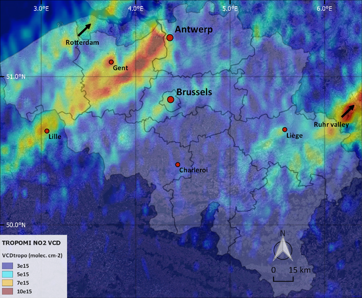
The instrument performs daily observations and thus provides valuable emission information from urban and industrial areas, as well as a clear overview of the NO2 distribution throughout the Benelux area. An example of the daily NO2 observations is given in this figure. It shows the downwind NO2 transport from the major Belgian cities, as well as from the Ruhr and Rotterdam industrial areas.
The Royal Belgian Institute for Space Aeronomy (BIRA-IASB) has recently developed a method to create daily and monthly global NO2 concentration maps, which will be integrated in the Terrascope platform to generate global daily and monthly air quality maps.
Generating global daily and monthly air quality maps
The integrated approach: satellites, airplanes, and air quality models
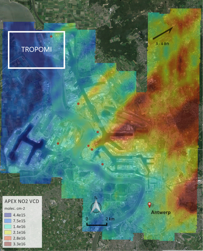
To resolve NO2 concentrations at even finer spatial scales and to augment satellite air quality measurements, airplane measurements have been performed. In the project Belgian Urban NO2 Monitoring Based on APEX remote sensing (BUMBA, funded by the Belgian Science Policy Office), BIRA-IASB, VITO Remote Sensing, and IRCEL-CELINE performed NO2 concentration measurement flights over the cities of Antwerp, Brussels, and Liège. These measurements were carried out using the spectral imaging Airborne Prism Experiment (APEX) instrument.
An example of these airplane NO2 measurements is displayed in this figure. It shows that airplane observations potentially add value to the interpretation of satellite observations and allow for refined industrial NO2 source identification. However, airplane measurements are labor-intensive and costly, which limits daily coverage over large areas, as opposed to the TROPOMI measurements.
Both airplane and satellite data are increasingly used to improve air quality forecast models, such as the Belgian ATMOSYS/RIO-IFDM model. All satellite data collected within the European Copernicus Programme are freely available, for example through the European Space Agency (ESA) Sentinel Hub. TROPOMI daily and monthly NO2 images are currently implemented in the Terrascope viewer and will be available to users by the summer of 2020.
This case is published in cooperation with BIRA-IASB.


