Monitoring deformation of bridges using Sentinel-1
Monitoring of large structures like bridges is usually done by performing leveling surveys once every few years. Although the results are very accurate, it is a very expensive approach and therefore it is not affordable for authorities to perform these surveys with a higher frequency. In the MOSCI project, IMDC and VITO looked into the feasibility of using InSAR. This remote sensing technology uses freely available Sentinel-1 data to monitor hundreds of bridges at the same time with significantly lower cost and much higher frequency.
Bridge inspection in Flanders
There are more than 3500 bridges in Flanders and assessing the structural health of these bridges is a challenge for the authorities. These bridges are visually inspected and leveled every 3, 4 or 5 years based on the location, age, load, construction, etc. of the bridge. Levelling is used in surveying to establish the elevation of a point (for example on a bridge) relative to a datum, or to establish a point at a given elevation relative to a datum. Levelling is very accurate and it will lead to knowing the exact location of possible settlement. However it is also very expensive, time-consuming, labor intensive and it requires safety measures. By using Interferometric Synthetic Aperture Radar (InSAR) techniques, we can support monitoring efforts of man-made structures like bridges over time and obtain subsidence time-series.
Obtain subsidence time-series with InSAR technology
InSAR monitoring
MoSCI (Monitoring from Space for Critical Infrastructures) is a joint project of IMDC and VITO which results in a suite of web based subscription services with a capacity to store and process satellite and airborne observation (i.e. drones, LIDAR) datasets - spanning over a wide range of spatial and temporal resolutions. Within this ESA funded project, the InSAR technology was demonstrated to monitor several bridges in Flanders as one of the critical infrastructures.
When the satellite passes through the same position in its orbit (almost 700 km above the Earth), InSAR algorithms can measure changes in elevation at millimeter scale on the ground. Through InSAR, part of the signal which represents deformation over time is calculated while other parts like atmospheric effects are removed. Here, they used Sentinel-1 images (Single Look Complex) over Belgium and a free virtual machine, both from the Terrascope platform, to set up the InSAR processing chain. This allowed them to apply the Persistent Scatterer Interferometry (PSI) method in 6 days revisit time of Sentinel-1 images from 2016 till 2021.
The advantages of using InSAR
- Support monitoring efforts of man-made structures like buildings
- Monitoring deformation of critical infrastructures like bridges, roads, dikes and dams
- Support governments, infrastructure officers, policy makers, ...
- Monitor several infrastructures at the same time within same swath of imagery (250 km wide)
- Weather independent monitoring, it works regardless of clouds, fog or darkness.
- Reducing survey time and cost

InSAR monitoring might help to build up an alarm system which automatically indicates bridges with possible defects, problems or high deformation rate.

Products and Services

Sentinel-1
The MOSCI project used Sentinel-1 images (SLCs) with interferometric capabilities to make deformation maps over bridges.

Virtual Machines
Terrascope cloud virtual machines have all satellite data locally available for processing and analysis.
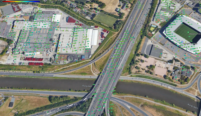
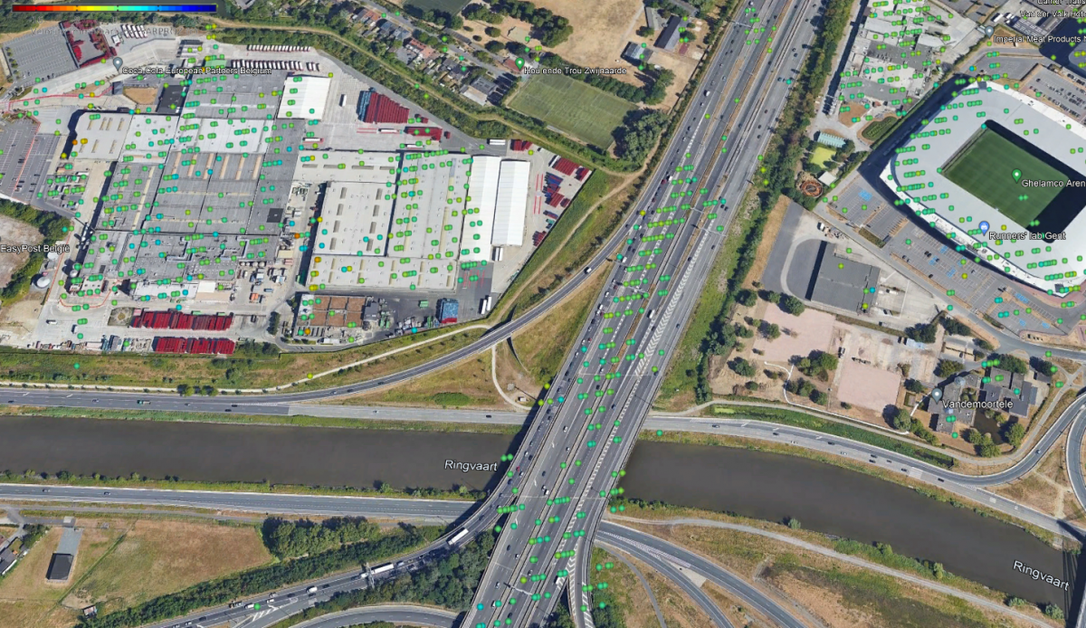
Indication Map
Users can get deformation time-series and velocity at mm/year scale which can be used as an indication of potential structural problems over a bridge.
