Monitoring the impact of wildfires on the air quality with Sentinel-5P
Although wildfires are a natural phenomenon, they have shown to be particularly intense around the world in recent years, causing large emissions that can have significant impact on our environment and public health.
The year 2023 is no exception, with intense wildfires in Canada, the United States, Hawaii and several Southern European countries. Sentinel-5P TROPOMI satellite data allows us to monitor air quality on a global scale. Discover more about the air quality data available via Terrascope to monitor e.g. toxic gases like formaldehyde during the Canadian wildfires.
Monitoring the impact of major wildfires
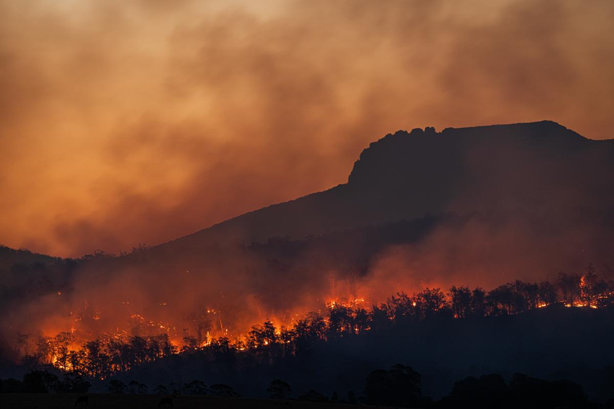
Major wildfires cause immense destruction of natural and residential areas devastating both human and animal life. Apart from the immediate environmental destruction, wildfires also come with a severe deterioration of air quality, with gases and aerosol such as carbon monoxide and formaldehyde. These emissions can spread over thousands of kilometres from their source of origin with significant impact on our environment and public health. When present in large quantities, several of these gaseous components are known to pose health risks in the form of respiratory problems to human and animal life.
In 2019 and 2020, fires in California and Australia drew attention because of their exceptional duration and intensity. The year 2023 is no exception, with intense wildfires all over the world emitting tons of carbon dioxide into the atmosphere which pose severe health and environmental risks. Monitoring and mitigating the impacts of wildfires is a complex challenge in which satellite data is extremely valuable to monitor air quality on a large scale and determine necessary measurement crucial to minimize the impact. Using spectroscopic techniques, satellite sensors can determine the densities of gas species that are invisible to the human eye and regular camera’s on the Earth’s surface and in space. These measurements play a crucial role in order to assess the creation, spread and destruction details of these emitted gases.
Sentinel-5P satellite data for air quality monitoring
Sentinel-5P TROPOMI (Tropospheric Monitoring Instrument) is a cutting-edge satellite sensor that delivers high-quality data to monitor air quality on a global scale. With its exceptional precision (resolution of 3.5×5.5 km2) and global coverage, TROPOMI provides extremely valuable data to assess the impact of major wildfires on our air quality and issue timely warnings to safeguard public health. Terrascope provides a series of Sentinel-5P air quality data to monitor a series of atmospheric gas species even when emitted by moderate bush fires.
These data products are provided in collaboration with the Belgian Institute for Space Aeronomy (BIRA-IASB), the Royal Netherlands Meteorological Institute (KNMI) and VITO Remote Sensing, and provided via the Terrascope services. Users can easily search their region of interest, compare areas over time, download data or integrate the data several processing chains.
Terrascope offers several data products derived from Sentinel-5P TROPOMI including gridded daily, monthly and yearly air quality maps.
- nitrogen dioxide (NO2, largely resulting from traffic, industrial processes and fires)
- carbon monoxide (CO, incomplete combustion processes)
- formaldehyde (HCHO, created in the photochemical degradation processes of organic molecules)
- methane (CH4)
Apart from timely warnings these data products are also extremely valuable to assess the long-term consequences of wildfire-related pollution on local ecosystems and climate change.
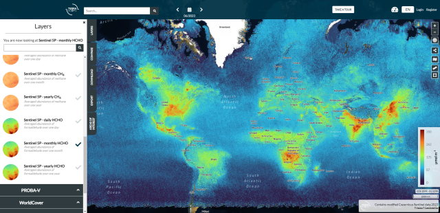
Animation of Sentinel-5P average abundance of daily formaldehyde (HCHO) on a global scale between May-August 2023. © Terrascope 2023
Formaldehyde and carbon monoxide measurement during the Canadian wildfires
The 2023 wildfire season has been particularly intense with large and intense wildfires all over the globe. Canada, among other places, experienced some devastating wildfires. Exceptional heat and dry conditions, combined with widely scattered lightning strikes, caused some of the worst fires in Canadian history. Various regions were affected with of course also a large impact on the air quality. According to the CAMS global forecasts and analyses, these wildfires have led to the total estimated emissions of carbon emissions for 2023 to be almost 410 megatons.
Although the lifetime of CO-molecules is much longer than that of HCHO, allowing for CO-monitoring over thousands of kilometers, the formaldehyde concentrations originating from the Canadian fires (see the animation above) were sometimes so high that the HCHO plumes could be followed on their way south into the United States. This was, for example, the case in the early days of June, when large quantities of toxic gases and aerosol particles covered the US eastern coastal area and caused strongly reduced visibility, like in New York City.
The TROPOMI animations highlight the relevance of using satellite data in the monitoring of natural hazard events like forest fires. Where the monitoring of carbon monoxide aides in a quick assessment of the spread of the toxic fumes, formaldehyde is a better indicator to localize sources. The monitoring of toxic gases therewith facilitates a quick response to wildfire events.
These high-quality data products are of interest to a variety of users:
- public authorities
- international organizations
- research institutions
- policy makers
- weather forecasts
- climate scientists
- health authorities
- students
- citizens
- …
Facts & figures
6,118
In September 2023, more than 6,000 fires had already burned 173,598 square kilometres, more than six times the long-term average for that time of the year.
410
Almost 410 megatonnes of carbon emissions were emitted by the Canadian wildfires.
Since
Terrascope provides global daily HCHO maps as of May 2018. Monthly averages go back to June 2018 and yearly to 2019.


These Sentinel-2 images shows the spreading of wildfire in Donnie Creek, Canada. On the image of 28 April 2023 there’s no wildfire yet. On the other two visuals, one month later, you can see the start of the wildfire (May 16) and how fast it spread in two days time (May 18). These images are produced and shared by the Copernicus Data Space Ecosystem.
Products and services
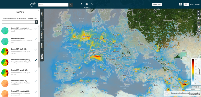
Nitrogen Dioxide
Terrascope provides access to daily, monthly and yearly average abundance of Nitrogen Dioxide (NO2), largely resulting from traffic, industrial processes and fires.
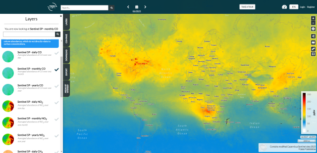
Carbon Monoxide
Access daily, monthly and yearly Carbon Monoxide (CO, incomplete combustion processes) data.
Formaldehyde
The average abundance of Formaldehyde (HCHO), created in the photochemical degradation processes of organic molecules, is a good indicator to localize the source of toxic fumes.
This case is published in cooperation with
Jeroen Van Gent - BIRA-IASB.