Monitoring the volcanic eruption on La Palma
On 19 September 2021, the Cumbre Vieja volcano on La Palma (Canary Islands, Spain) started to erupt for the first time since 1971. Together with the outflowing lava, the crater ejected large ash plumes containing several gases, among which sulfur dioxide (SO2). Volcanic ash and SO2 are dangerous to public health and aviation. Therefore, tracking and monitoring these plumes and their constituents is very important.
The Tropospheric Ozone Monitoring Instrument (TROPOMI) onboard the Copernicus Sentinel-5P satellite provides observations from which the atmospheric SO2 amount can be obtained at an unprecedented 3.5 × 5.5 km2 spatial resolution. However, SO2 is also observed by other sensors, such as the Infrared Atmospheric Sounding Interferometer (IASI) onboard the MetOp satellites and the Spinning Enhanced Visible and Infrared Imager (SEVIRI) onboard the geosynchronous Meteosat satellites.
Monitoring SO2 transport with three satellites
The plumes and SO2 transport over northern Africa and southern Europe for 21 – 28 September 2021 as observed by three satellite sensors are shown in the animation below. Cumbre Vieja’s location is indicated by the red triangle.
- The lower left panel shows the daily SO2 plume height derived from IASI observations (provided by the Free University of Brussels; ULB).
- The upper left panel shows daily TROPOMI SO2 vertical column density (algorithm developed by the Royal Belgian Institute for Space Aeronomy; BIRA-IASB)
- The right panel shows the hourly Volcanic Ash false-color composite product from the Atmospheric Composition Satellite Application Facility (AC SAF)
TROPOMI SO2 vertical column density (upper left), IASI SO2 plume height (lower left), and SEVIRI Volcanic Ash composite (right). The Cumbre Vieja location is indicated in the right panel by the red triangle, the various false-color composite interpretations are indicated to the right. The time tags in the TROPOMI and IASI panels denote the satellites’ overpass times (in UTC) at the given locations.
The animation shows that initially the SO2 plume was located in the Canary Islands surroundings, but from 23 September onwards the plume was transported towards Spain, France, and Italy. The IASI SO2 plume height (lower left panel) indicates that the bulk SO2 was mostly located at 5 – 8 km. This animation shows the added value of combining complementary observations from different satellite platforms, using different spectral information and different temporal resolutions.
SO2 average maps available in Terrascope in 2022
Together with BIRA-IASB, we will start efforts on making Sentinel-5P TROPOMI SO2 daily, monthly, and yearly average maps available in our Terrascope Viewer in the first half of 2022, adding to the already existing CO and NO2 data products. Stay tuned for more information in the next months!
Discover more Sentinel-2 images below and explore the data via our EO viewer.
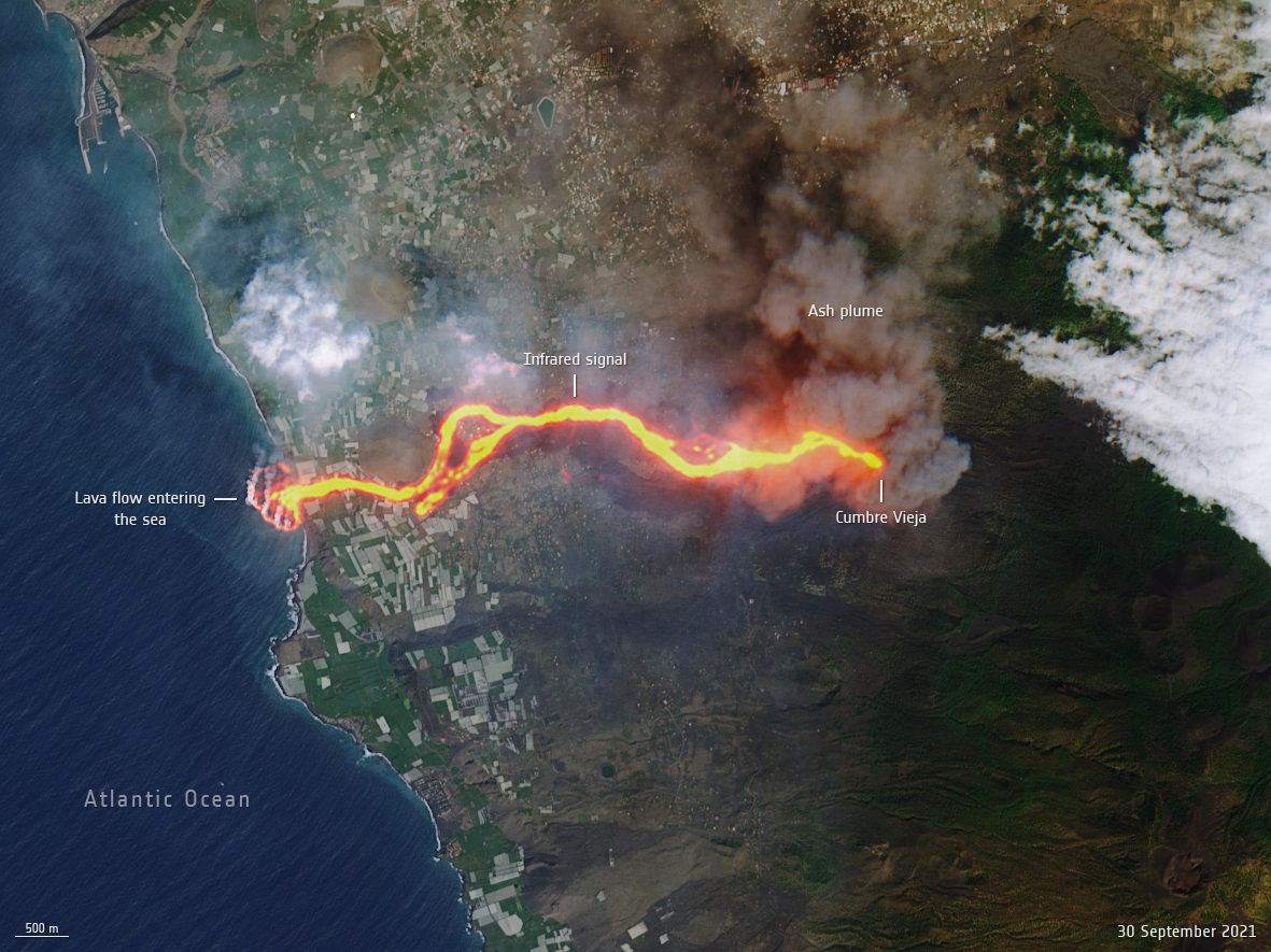
This image, captured by the Copernicus Sentinel-2 mission on 30 September, shows the flow of lava from the volcano erupting on the Spanish island of La Palma. The cascade of lava can be seen spilling into the Atlantic Ocean, extending the size of the coastline. This ‘lava delta’ covered about 20 hectares when the image was taken. Click here to view more or download the high resolution file.
© contains modified Copernicus Sentinel data (2021), processed by ESA, CC BY-SA 3.0 IGO
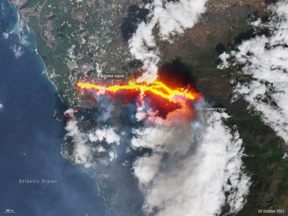
This image, captured by the Copernicus Sentinel-2 mission on 10 October, shows the new flow of lava from the volcano erupting on the Spanish island of La Palma.
© contains modified Copernicus Sentinel data (2021), processed by ESA, CC BY-SA 3.0 IGOlcano erupting on the Spanish island of La Palma.
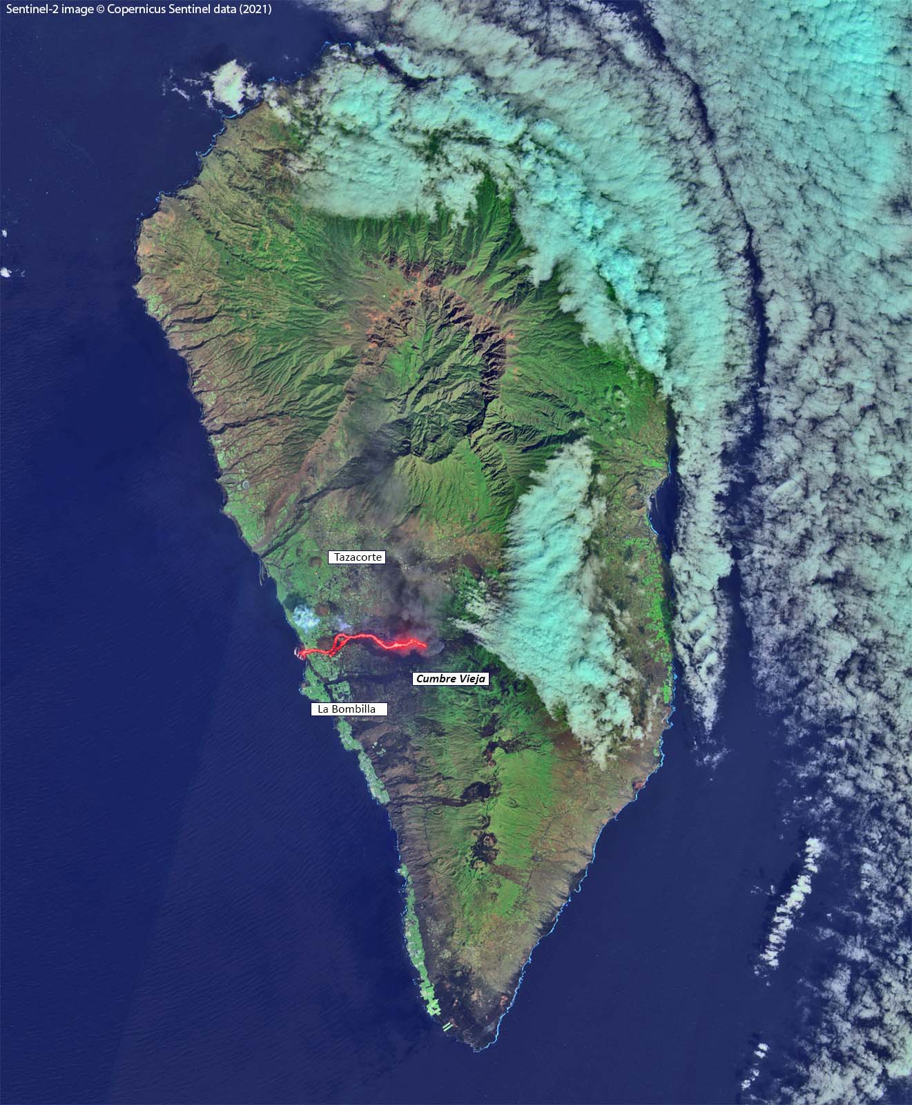
Sentinel-2 image of La Palma of 30 September 2021
© contains modified Copernicus Sentinel data (2021), processed by VITO Remote Sensing
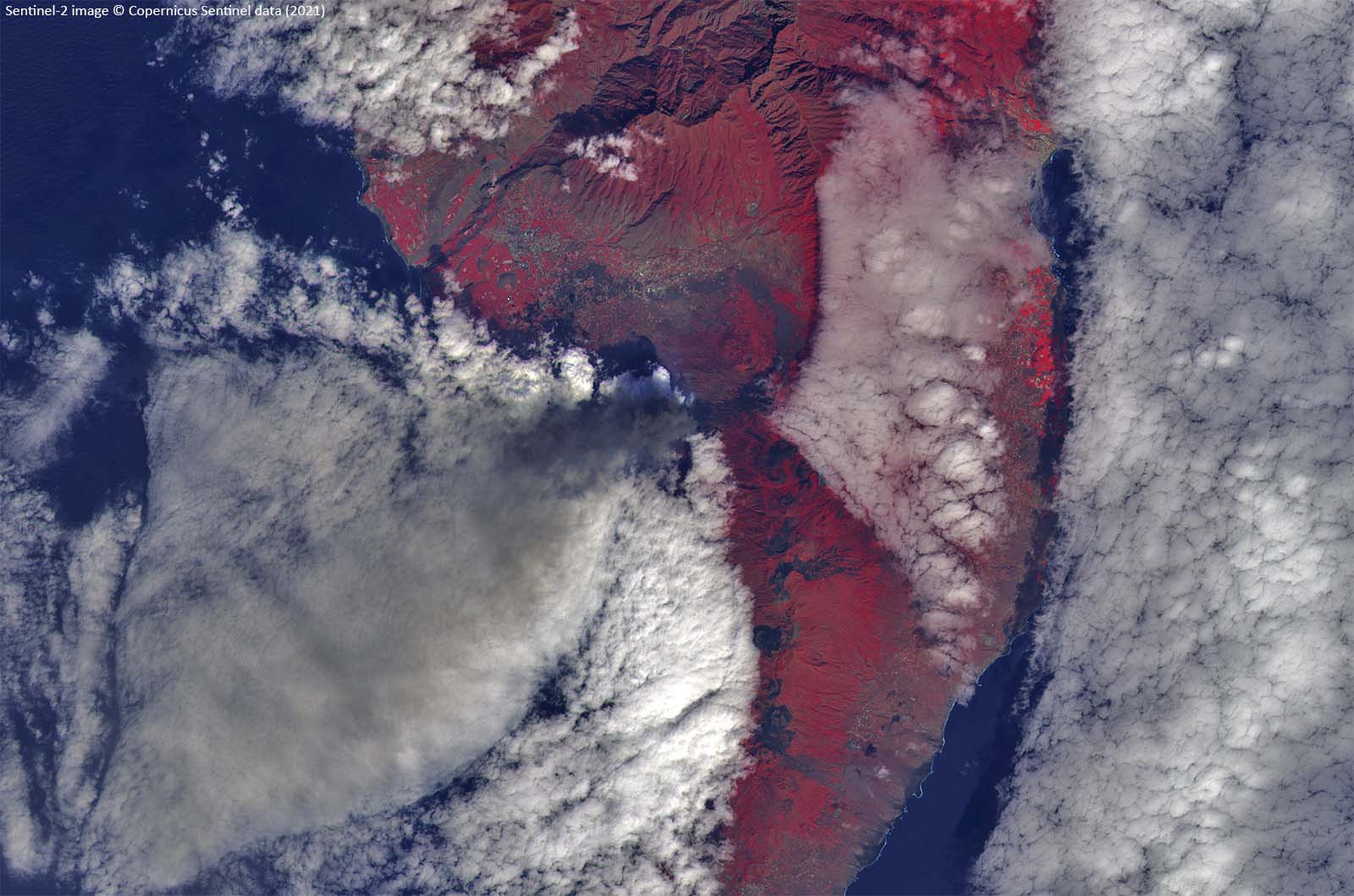
Sentinel-2 image of La Palma of 5 October 2021
© contains modified Copernicus Sentinel data (2021), processed by VITO Remote Sensing
We thank Hugues Brenot (BIRA-IASB) for providing the animation obtained in the frame of the H2020 project ALARM and in collaboration with the Royal Meteorological Institute of Belgium (IRM-KMI), for providing near real-time access to SEVIRI data.
