Our services: reach higher and dig deeper with satellite data
Our free public viewer provides access to a wealth of satellite data in various layers. We also offer additional services. This allows you to get started with the data and to easily integrate it into your familiar software. Opt for:
- EOplaza – third-party services available via Terrascope
- Web services – protocols for downloading images and integrating them into GIS software
- Notebooks – programming environment to quickly access and edit data
- Virtual Machines – external computer used to view data and process it in the cloud
- Data access – direct access to satellite data
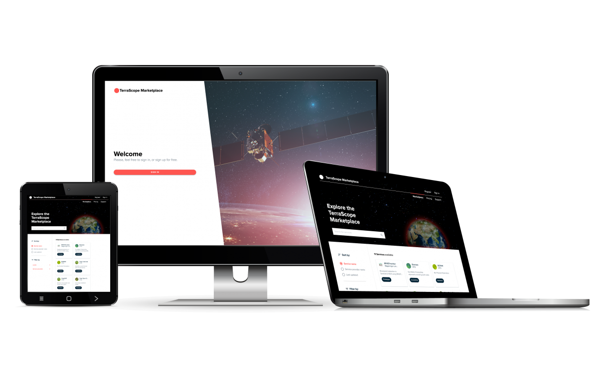
Our EOplaza – an ecosystem for Sentinel data
Terrascope is constantly improving its EO services to keep meeting our end users’ needs. With the Terrascope EOplaza we can expand the offer unrestrictedly and match up demand and supply for EO services.
The Terrascope EOplaza is a valuable and innovative platform to access and offer a variety of high-quality EO services and it brings end users and service providers together. For end users, it is the place to discover EO services that meet their requirements. For service providers, it is an easy and reliable way to offer their technology to a global community.
As an end user you are able to:
- Access third party services in just a few clicks
- Use quality controlled EO services at transparent rates
- Use additional processing power at a fair and transparent price, on top of our basic and free Terrascope data and processing services
As a service provider you can:
- Use our EOplaza business framework to reduce your development costs
- Define your own added value share as revenue
- Receive professional support to smoothly implement your services
- Expand your reach by offering services to the Terrascope community, reaching thousands of end users
Web services - Hit the ground running with Sentinel-2
These OGC (Open Geospatial Consortium) protocols help you to download images and integrate them into GIS software for further analysis.
1. Satellitedata in tile format
With OGC WMTS (Web Map Tile Service) you can request satellite data from an area in the form of small tiles. This is of particular interest if you want to use them for your GIS analysis (e.g. in QGIS) or if you want to develop your own application.

2. Random size images
With OGC WMS (Web Map Service) you can request Sentinel-2 images of random size (e.g., 2,000 pixels) at once, hence not using tiles. You can subsequently integrate them into your GIS software and use them for informed decisions on infrastructure and spatial planning, among others.
3. Satellite images in TIFF or GeoTIFF
With OGC WCS (Web Coverage Service) you download satellite imagery through the web server and the files will be sent to you in the desired format: TIFF or GeoTIFF. This is useful if you wish to keep the data yourself.
Warning: you need a login for this service.
The OGC WCS is temporarily unavailable.
Notebooks
Web environment on the Terrascope server in which you can work directly with satellite data
- Start with the data in the programming language you are familiar with.
- Easily track and export the data you need in the code.
- Do not just work in the code, but also add information about the code. This is useful for secondary and higher education.
Virtual machines
Virtual computers on the Terrascope server that make all satellite data available locally and on which a number of open-source applications are installed – for example, QGIS.
- Immediately start analysing the data.
- Do not waste time: you do not have to wait until the data is downloaded.
- Save on extra storage space and computers (because satellite images require a lot of space and processing power).
- Download your analysis in an easily manageable format.
The standard capacity of a free VM is 4 cores and 8 GB RAM and 80 GB HDD disk space
If you need more capacity, you can use ESA's NoR. Click here for more info.
Attention: to request a VM, you need to have credentials. Please log in or register by clicking "sign in" in the top menu.
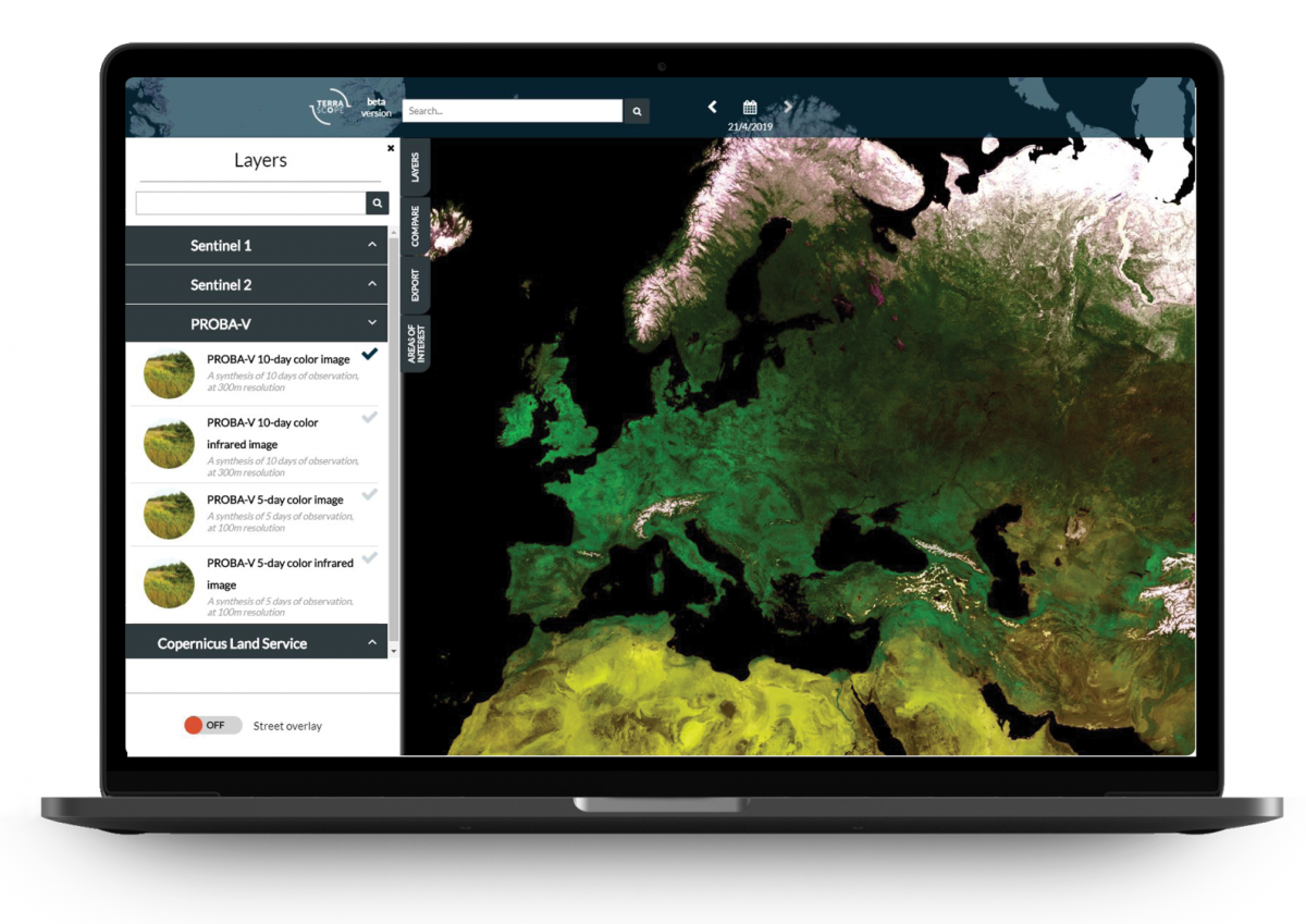
Data access - Satellite data to be processed by you
The viewer provides fast access to satellite data including Sentinel. You can easily search, view and compare various data layers. Via the ‘Export’ tab you can even download png images, GIF timelapses or the original data in just a few clicks.
Would you like to implement your own processing? In that case, you can also directly retrieve the satellite data. You can do so through our data portal.
Data from Sentinel-1
Explore radar data that is continuously collected, even in overcast conditions. This is useful, for example, to support aid services during extreme weather conditions.
Data from Sentinel-2
Get a new perspective on land and vegetation with the Sentinel-2 optical data. The multispectral image sensor allows for images of up to 290 km wide, with a resolution of up to 10 metres.
Data from Sentinel-3
Oceans, land, ice and atmosphere. These are the areas in which the data from Sentinel-3 excels. The data helps to keep a close eye on global developments.
