WaterMonitor: detecting algae by satellite
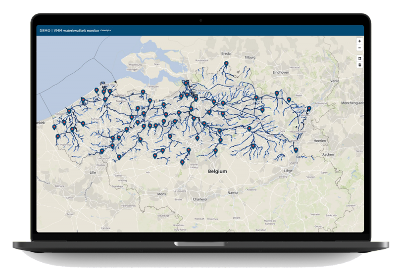
Detecting algae on a large scale requires a huge investment. In addition, not all water bodies can be checked in a timely manner and some algae can lead to major health issues for humans and animals. By using satellite imagery, the WaterMonitor tool detects algae in a large number of Flemish lakes, rivers and canals.
Comprehensive view of Flemish waterways
The WaterMonitor uses our satellite data and services. The tool adds critical information, such as chlorophyll content (an important indicator for the presence of algae), and allows users to search specific water bodies. In this way, the tool can show a comprehensive overview of a large number of waterways and open waters several times a month.
What happens to our water
WaterMonitor maps a large number of Flemish water bodies and provides critical information to safeguard public health.
WaterMonitor provides insight to:
- water managers
- water companies
- operators of bathing waters
- fishermen
- the public
- Algae spotted from the sky
WaterMonitor provides an overview of the chlorophyll content in water. A higher content may indicate that the algae biomass has increased. The tool is a useful addition to local sampling.
- Fresh data every 5 days
WaterMonitor retrieves its information from the Sentinel-2 satellites, which pass by every 5 days. Chlorophyll content is derived from the collected data and processed in reports or alert systems.
- Various locations and times
Today WaterMonitor is available in a demo version for the Flemish Region and the Flemish Environmental Agency (VMM). This demo is aligned with the VMM's monitoring locations, but can also include other locations. When users select a location, the WaterMonitor retrieves all available chlorophyll data from the database for different times. The tool also adds the results of VMM sampling.


