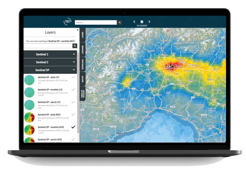
Sentinel-5P air quality data now available
Since January 26, 2021 you can access Sentinel-5P air quality data via our Terrascope services. The Tropospheric Ozone Monitoring Instrument (TROPOMI) onboard the Sentinel-5P satellite performs observations on various atmospheric constituents (such as aerosols and trace gases) and provides valuable air quality data at an unprecedented sub-urban scale (3.5 × 5.5 km2) every day. These data are among others suitable for:
- monitoring the air pollution amount
- assessing its impact on vegetation and public health
- improving air quality models
- issuing aviation warnings
- tracking ship emissions
Air quality is increasingly gaining attention worldwide. Both anthropogenic (fossil fuel emissions by road traffic and industry) and natural events (e.g. wild fires, volcanic activity) impose serious problems to both human and natural environments from local to global scales. Therefore continuous and accurate air quality monitoring using satellite observations is very important.
In this context, we are very happy to provide the Sentinel-5P/TROPOMI data products via our Terrascope services! Via our EO viewer, you can easily survey daily, monthly, and yearly averaged NO2 and CO column densities at a global scale, compare two dates, and analyze the NO2 and CO evolution through time for your area of interest.
Discover the Sentinel-5P data yourself via our EO viewer, and access more detailed information on the NO2 and CO data products in the Terrascope Documentation Portal.

